Apple Maps now shows the borders of Indigenous land in Australia and New Zealand.
Apple Newsroom:
Beginning today, Apple Maps now displays Indigenous lands in Australia and Aotearoa New Zealand. By gathering information from Indigenous advisors, cartographers, Traditional Owners, language holders, and community members, Apple Maps will show reserves and Indigenous Protected Areas, Indigenous place names, Traditional Country, and dual-language labels. Indigenous lands place cards feature information about the local area and Traditional Owners, and can be curated to allow communities to add their own photos, destinations on their land, and text in their own language. Representation of Indigenous lands in Apple Maps provides users with a more comprehensive experience while also recognising the stories and significance behind them.
Apple Maps will now include more than 250 dual placenames for cities and towns across the country, with more to be added.
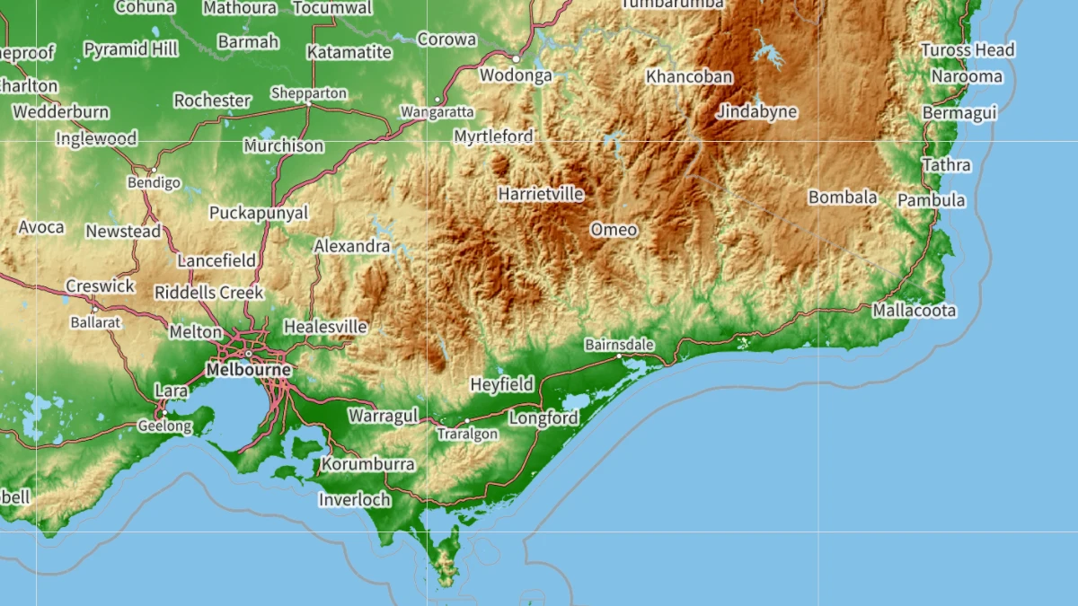
I’m struggling to confirm this. On the latest versions of both macOS (15.3.2) and iOS (18.3.2), no traditional place names are shown instead or in addition to the English names. It’s technically feasible to show two names simultaneously for a location, as we’ve seen with Gulf-of-Mexico travesty—it just hasn’t been done.
When I search for “Naarm,” the traditional name of the Melbourne area, only “Melbourne” shows up as a match. Likewise, a search for “Gadigal” or “Cadigal” returns matches in the Sydney area, like “Gadigal Station,” but not Sydney itself.
If you are a student or early-career developer and want to make your mark in open-source geospatial, the following geospatial organisations are participating in the 2024 Google Summer of Code:
The Protomaps project, a set of protocols and software for serving fast map tiles over the Web, is transitioning to a new funding model.
Previously, Protomaps’ main source of funding was selling one-time downloads of basemap tiles. Now you can purchase access to commercial, hosted tile APIs and hands-on support through the project’s GitHub sponsorship page:
For $14, you get one million tile requests via the commercial API. The tileset is derived from the Daylight Map Distribution, which includes data from OpenStreetMap but has gone through additional quality checks.
For $140, you get fifty million tile requests via the API, plus an optional downloadable tileset in case you’re looking to host the tiles more cost-efficiently should you exceed the allowance.
Then there are two access tiers for $2,000 and $4,000, which give you access to Protomaps developers to provide support and consulting services.
In addition, all components needed to produce PMTiles and run the Protomaps infrastructure are open source; you can run the APIs yourself for the infrastructure cost only.
Developing open-source projects and financing them by selling professional services for development, maintenance and knowledge transfer is an idea some German geospatial businesses, like Terrestris or Wheregroup, have successfully implemented for years. But I haven’t seen it yet for a company selling map tiles.
Development Seed’s data team in Ayacucho, Peru has spun out to form GeoCompas:
I am pleased to announce that the skilled data and annotation team from DevSeed is separating to become an independent employee-owned company called GeoCompas. The Geo AI practice at Development Seed has grown, and the GeoCompas team has been essential in providing crucial mapping, annotation, QA, and automation support. Their expertise in geodata is now available to everyone.
The new company focusses on OpenStreetMap editing, data labelling and annotation for AI projects, but also development of data processing pipelines and web services.
Placemark is the map editor software-as-a-service that I built for several years. It’s a website where you can import, create, edit, export, publish, and visualize geospatial data.
Sad news from Placemark today, the platform is shutting down in January:
Well, I’ve made the decision to wind down my efforts on Placemark - it’s been a lovely journey thanks to great folks using it (like you!) but ultimately wasn’t self-sustaining financially.
Starting today,
New signups will be disabled
Existing paid users will have free access until January 19, 2024
In January 2024 I’ll release the full source code for the application as open source
The writing has been on the wall since Tom MacWright wrote in January:
I’ve envisioned it as a tool that you can use for simple things but can grow into a tool you use professionally or semi-professionally, but maybe that’s not the future: the future is Canva, not Illustrator.
Tom was the creator and only person who worked on Placemark (as far as I know). It’s hard to compete as a one-person company, when products as impressive Felt launch at the same time.
A short programming announcement: In addition to Twitter and Mastodon, I’ve started posting updates to Bluesky.
I also have a couple of Bluesky invites to give away. If you’re interested, shoot me an email at letters@latlong.blog. Yes I prefer email; I’m that old. I’ll send the invites out on a first come, first serve basis. I will be using your email adress for this purpose only, I won’t store your email or sign you up for a newsletter.
I’d like to use the occasion to remind everyone that the feeds are the best way to get notified of new content on the site. No sign-up required, you get full articles delivered to your favourite feed reader, and you get to support the open web.
Geofencing business Radar introduced a new suite of APIs, aiming to get a slice of Google Map’s and Mapbox’ business:
Radar Maps Platform has it all, including base maps, geocoding APIs (forward geocoding, reverse geocoding, IP geocoding), search APIs (address autocomplete, address validation, address autocomplete), routing APIs (distance, matrix, route optimization, route matching, directions), and UI kits (address autocomplete).
Our beautiful vector base maps support classic, dark, and light themes. You can easily add base maps and UI kits to your website with v4 of the Radar JavaScript SDK.
There is nothing ground-breaking in the announcement; the features offered in the platform are the pretty standard. But Radar’s pricing is competitive, so you might as well keep this one on our radar. (Yeah, I love a rubbish pun.)
A new map style has been added to the OpenStreetMap site:
It’s a mix of osm-carto and OpenTopoMap. It has many improvements: more tag support (busway, embankment, cuisine, solar plants, aquaculture, pitch, sea, tree etc.), CJK fonts, etc. There is also better internationalisation: country specific road shields, peaks using imperial system in the US, hierarchical place rendering in China, etc.
Zoomed in, it looks a lot like the standard OSM styled. In lower zoom levels, it reminds me of school atlases I grew up with. Very nice.
Stamen won’t be hosting their iconic and very popular map tiles any more. Instead, Stadia Maps will host Stamen’s maps tiles going forward:
We’re partnering with Stadia to move our tiles to their servers, and working closely with them to make sure that our beloved map styles keep running well into the future, and better than ever. They’re experts in running well-maintained map serving infrastructure. For most users, switching over will be as simple as setting up a Stadia account, and changing a few lines of code. For most non-commercial customers, there’ll be no service disruption, no tracking, and the price tag will continue to be free.
Stamen’s tile service will be discontinued in October; until then existing tile URLs will redirect to Stadia’s servers.
What this means:
You’ll need a Stadia Maps account.
You need to point your application to the Stadia URLs by October.
You might have to pay if you’re application serves more than 200,000 tiles per month or if you’re using the tiles with a commercial application.
All Stamen map designs will be ported to Stadia, and most styles are now available as Vector tiles too.
Considering Stadia’s generous free tier this is a fair compromise. Stamen generously made their tiles available for free for a very long time. Running a tile service needs people and the infrastructure costs money, and we can’t take it for granted that a small cartography shop provides an essential service for free forever.